Faethon Trail: Kokkinopilos – Vrysi Vnti – Vrysi Tsoureka
A circular hike from the village past two mountain springs and back, on the route of the Faethon trail. The gentlest way to get to know the forests around Kokkinopilos.
Mountain · Routes and safety
Hiking routes, shelters, maps and current conditions for the trails around Kokkinopilos. Always check conditions before you set out.
All green No closures or warnings on the routes, walks and refuges checked so far.
A circular hike from the village past two mountain springs and back, on the route of the Faethon trail. The gentlest way to get to know the forests around Kokkinopilos.
The first mountain section of the European long-distance path E4 on Olympus: a demanding, constantly uphill hike from the village square through the Stalagmatia ravine to the Christakis refuge.
Official Olympus National Park route through the Stalamatia gorge to the alpine plateau, the emergency refuge at Megali Gourna and the summit ridge at Skala (2,866 m).
Official Olympus National Park route through thick forest to the Roudi spring and along the ridge of Kitros (2,416 m), Nana and Steni Salatoura, down to the Xerolakki stream.
Adventure without leaving the village.
Easy walks that start in the village and stay close to it. More relaxed than the mountain routes.
A short loop from the village up to the chapel of Agios Athanasios, the highest point of Kokkinopilos, past the Perivoli memorial.
2 points of interest · 4 junctions
A night at around 2,500 m on Olympus: the unguarded Christakis refuge at Laka Christakis, where the first E4 section from Kokkinopilos ends. Two open buildings with bunk beds for roughly 20 people.
Emergency refuge on the route from Kokkinopilos to Skala, at the basin of Megali Gourna.

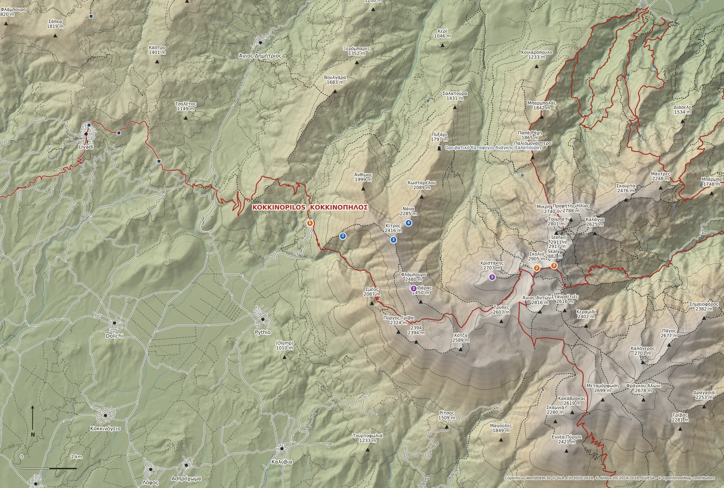
Shaded relief with contour lines every 100 m; paths, peaks and refuges from OpenStreetMap. Not a navigation map: carry a proper hiking map such as Anavasi Olympus 1:30,000.
Elevation: produced using Copernicus WorldDEM-30 © DLR e.V. 2010-2014 and © Airbus Defence and Space GmbH 2014-2018 provided under COPERNICUS by the European Union and ESA; all rights reserved. The organisations in charge of the Copernicus programme by law or by delegation do not incur any liability for any use of the Copernicus WorldDEM-30. Map data © OpenStreetMap contributors (ODbL).
Each route is shown in its own colour as numbered landmarks from its description. Open a route for its own, more detailed map.
General guidance for walking in the mountains. Local hazards and seasonal warnings are added to each route and shown as alerts.
SafetyConditions on the mountain change quickly. This information is a guide only and does not replace your own judgement, a current forecast and proper equipment.