
Routes
Kokkinopilos – Kitros – Xerolakki
Official Olympus National Park route through thick forest to the Roudi spring and along the ridge of Kitros (2,416 m), Nana and Steni Salatoura, down to the Xerolakki stream.
Status unknownLast checked: Not checked yet
- Difficulty
- Moderate
- Distance
- —
- Duration
- —
- Ascent
- —
- Descent
- —
- Highest point
- 2,416 m
- Start
- Kokkinopilos (1,100 m)
- Finish
- Xerolakki stream, towards Petra
- Season
- —
- Waymarking
- Waymarking unknown
From Kokkinopilos (1,100 m) the path climbs through thick forest to the Roudi spring (1,800 m), then onto the ridge that joins Anthimos (1,198 m) with Kitros.
It follows the ridge line Kitros (2,416 m) – Nana (2,284 m) – Steni Salatoura (2,089 m), descends steeply to a sheep pen and continues on roads or along the Xerolakki stream to lower ground towards Petra.
The park calls it one of the lesser known, but most beautiful routes on Olympus.
Distance, ascent and walking time will be added from a recorded GPX track.
Known hazards
- The Roudi spring (1,800 m) does not have water all year round.
- Steep descent after Steni Salatoura.
Map
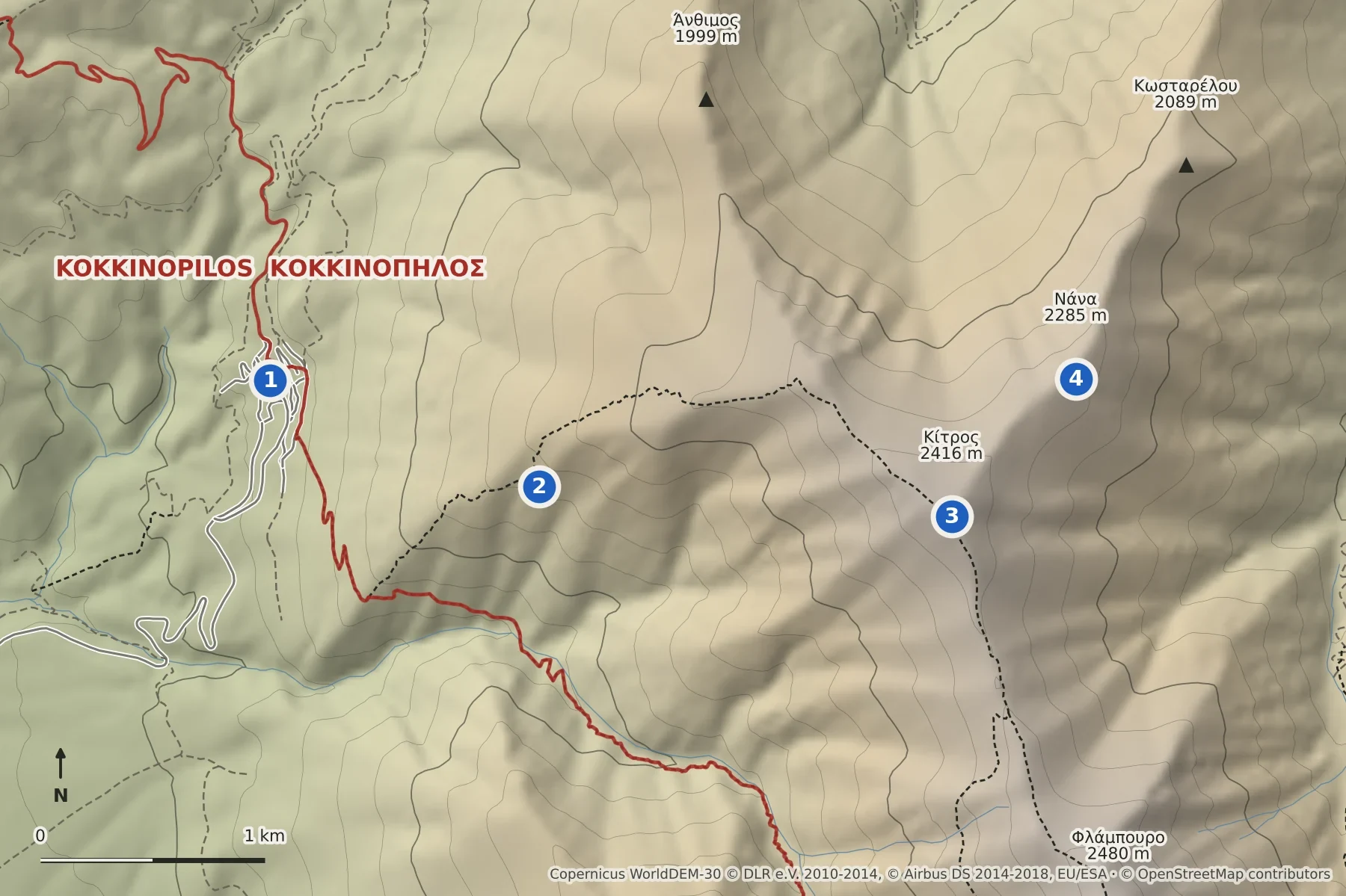
- Kokkinopilos, start
- Roudi spring
- Kitros (2,416 m)
- Nana (2,285 m)
The numbered points are landmarks named in the official route description, in walking order. The path does not necessarily pass over them. The route line will be drawn once a GPX track is available.
Shaded relief with contour lines every 100 m; paths, peaks and refuges from OpenStreetMap. Not a navigation map: carry a proper hiking map such as Anavasi Olympus 1:30,000.
Elevation: produced using Copernicus WorldDEM-30 © DLR e.V. 2010-2014 and © Airbus Defence and Space GmbH 2014-2018 provided under COPERNICUS by the European Union and ESA; all rights reserved. The organisations in charge of the Copernicus programme by law or by delegation do not incur any liability for any use of the Copernicus WorldDEM-30. Map data © OpenStreetMap contributors (ODbL).
A GPX track will be added once the route has been recorded.
Maps and further information
- Olympus National Park: Kokkinopilos – Kitros – Xerolakki (opens an external site)Official route description (difficulty: medium).
- Anavasi hiking map: Olympus 1:30,000 & 1:10,000 (opens an external site)Printed and digital hiking map covering this route (sold separately by Anavasi).
- EOS Kokkinopilou: trails and routes (opens an external site)The village mountaineering club describes the ascent Kokkinopilos – Roudi spring – Kitros as a mountaineering route through dense forest into the alpine zone.
Conditions on the mountain change quickly. This information is a guide only and does not replace your own judgement, a current forecast and proper equipment.